As technology advances, so does the field of surveying. The introduction of Differential Global Positioning System (DGPS) surveying has revolutionized the way we measure and map our world. Recently, I had the opportunity to dive into this fascinating field and experience the process of monitoring a DGPS survey firsthand. Join me as I recount my exciting journey and unveil the wonders of DGPS survey monitoring.
Setting the Stage
Upon arriving at the survey site, I was greeted by a team of experienced surveyors armed with high-tech equipment. They explained that DGPS surveying utilizes a network of ground-based reference stations and satellites to enhance the accuracy of GPS positioning. Unlike traditional GPS, DGPS corrects for signal distortions caused by factors such as atmospheric interference, ensuring precise measurements.
DGPS surveying utilizes a network of ground-based reference stations and satellites to enhance the accuracy of GPS positioning. Unlike traditional GPS, DGPS corrects for signal distortions caused by factors such as atmospheric interference, ensuring precise measurements.
Understanding the Process
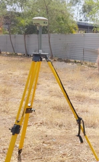
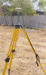
To begin with, a reference station is established at a known location. This station acts as a control point, providing accurate positioning information that could be used to correct any errors in real-time measurements. The reference station was meticulously set up, ensuring it was stable and protected from potential disturbances. Several portable rovers, GPS receivers were deployed throughout the survey area. These rovers were equipped with DGPS receivers capable of receiving correction signals from the reference station.
Once the survey was underway, the data coming in from the rovers was monitored. Throughout the survey, the team frequently communicated with each other, exchanging information and ensuring that all data was collected accurately.
Troubleshooting and Challenges
During time at the survey site, the surveyors tackled various challenges. The signal interference was encountered due to nearby buildings and dense vegetation, causing momentary disruptions in the DGPS data stream. However, the team employed strategies such as adjusting the rover’s position and using additional correction sources to mitigate these issues and maintain data accuracy.
At VGeotech Experts, our experience in conducting surveys all over India enables us to deliver reliable services with precision and accuracy. The experience of our Chief Consultant Dr. Abhinav Mane Ph.D from IIT Bombay, guides us in right direction and provide accurate services.