Road bridge survey works involve planning, design, and construction of roads and bridges and submission of a detailed project report (DPR) based on the survey and analysis.
Road bridge survey works in the Public Works Department (PWD) involve a range of activities that are critical to the planning, design, and construction of roads and bridges.
DPR (Detailed Project Report) preparation is the process of creating a comprehensive report that outlines the technical and financial aspects of a proposed road construction project.
The following are key components and processes involved in a bridge survey:
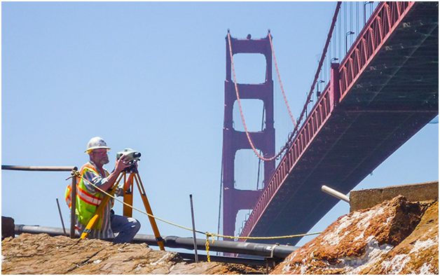
Preliminary Site Assessment: Involves evaluating the general conditions of the bridge location, such as the topography, geology, hydrological features, and existing infrastructure.
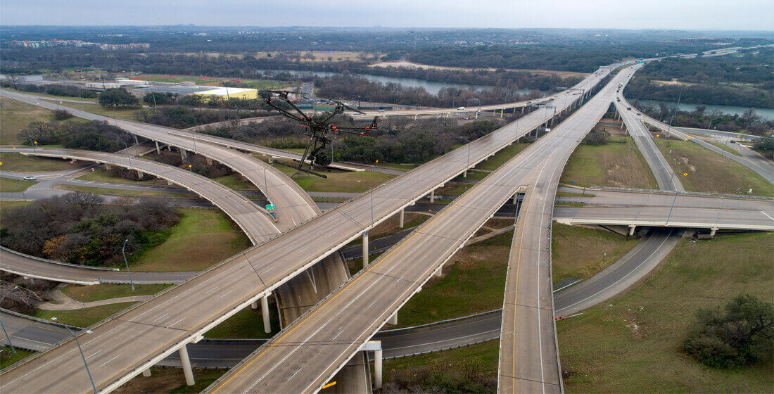
Topographic Survey: Involves mapping the terrain and capturing the precise elevation and location of the bridge site and its surroundings.
Geotechnical Investigation:
To assess the soil and subsurface conditions at the bridge site.
The geotechnical data obtained provides crucial information for foundation design, slope stability analysis, and determining the overall stability of the bridge structure.
Hydrological Analysis:
Bridges that span over water bodies require a hydrological analysis to evaluate factors such as water flow, water levels, flood risks, and sediment transport.
To determine the appropriate bridge type, dimensions, and hydraulic design parameters to ensure that the bridge can withstand anticipated water conditions and maintain functionality during floods or heavy rainfall events.
Structural Condition Assessment:
A detailed assessment of the existing bridge structure.
Involves inspecting the bridge elements, including piers, abutments, beams, decks, and joints, to evaluate their condition, deterioration, and any structural deficiencies.
Non-destructive testing methods, such as visual inspections, ultrasonic testing, and ground-penetrating radar, may be employed to assess the integrity and strength of the bridge components.
Load Assessment:
To determine the maximum expected loads that the bridge will bear during its design life.
Involves analyzing traffic patterns, vehicle types, and weights to establish appropriate loadings for the bridge design.
Ensures that the bridge can safely support anticipated traffic loads without compromising structural integrity.
Data Collection and Documentation:
Throughout the survey process, accurate and detailed data is collected using various surveying techniques, including GPS (Global Positioning System), laser scanning, photogrammetry, and traditional survey instruments.
The collected data is then compiled, analyzed, and documented in the form of survey reports, drawings, and digital models, which serve as references for design, construction, and maintenance activities.
Why Choose Us?
Topographic surveys – to map the terrain and other physical features of the site, including vegetation, waterways, and other natural or man-made features
Geotechnical surveys – to assess the soil, rock, and other subsurface conditions at the site
Hydrological surveys – to measure water levels and flow rates in streams, rivers, and other water bodies near the proposed road or bridge site to design drainage systems
Traffic surveys – to collect data on the volume and patterns of traffic flow on existing roads and highways, to design new roads and bridges that can accommodate expected traffic volumes and minimize congestion
Environmental surveys – to identify potential environmental impacts of road or bridge construction project.